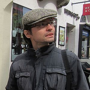
Hello, you are on the personal page of
Zoran Čučković
I’m a landscape archaeologist at the University of Clermont Auvergne (France). The study of ancient landscapes concerns various types of rural and urban settlements, field systems, ancient environement, ritual places and monuments – and much more. My approach puts space before place, I study connections between sites across the space and possibilities offered by such space. I also study how ancient populations got to know their space, what they made of it, and how such space made them think about themselves.
I’ve obtained a PhD degree at the University of Burgundy Franche-Comté (France). Previously I worked as professional archaeologist in Croatia, and currently I’m a research associate at the University of Clermont-Auvergne (France).

Web coordinates
Check LandscapeArchaeology.org, which deals with spatial analysis (GIS) and archaeology.
Other web coordinates:

Publications
… a selection
NEW: Čučković, Z. (2025). Landscape Chambers: Towards an Archaeology of the Cognitive Landscape. Journal of Archaeological Method and Theory, 32 (1), pp.20. DOI:10.1007/s10816-024-09687-0
Čučković, Z. (2023). Chapter 15. Visibility Networks. In T. Brughmans, B. J. Mills, J. Munson, M. A. Peeples (eds.) The Oxford Handbook of Archaeological Network Research. Oxford University Press, pp.230-247. DOI:10.1093/oxfordhb/9780198854265.013.13
Čučković, Z. (2017). Claiming the sea: Bronze Age fortified sites of the north-eastern Adriatic Sea (Cres and Lošinj islands, Croatia). World Archaeology vol 49, issue 4, pp. 526-546. doi: 10.1080/00438243.2017.1341331
Čučković, Z. (2016). Advanced viewshed analysis: a Quantum GIS plug-in for the analysis of visual landscapes. The Journal of Open Source Software 4(1). doi: 10.21105/joss.00032
Čučković, Z. (2015). Exploring intervisibility networks : a case study from Bronze and Iron Age Istria (Croatia and Slovenia). In F. Giligny, F. Djindjian, L. Costa, P. Moscati and S. Robert (eds.) CAA 2014 - 21st century Archeaology: concepts, methods and tools. Proceedings of the 42nd Annual Conference on Computer Applications and Quantitative Methods in Archaeology. Paris, April 2014: 469 - 478.
A full list of publications can be found on HAL page or on Academia.edu.

QGIS projects
… and other techy stuff
This site covers my Github account, which hosts two actively maintained QGIS modules:
- Visibility analysis module, which is widely used by GISers worldwide
- Terrain Shading module, made for analytical terrain visualisation of elevation data (eg. Lidar derived)
You can explore the GitHub account here, although it’s not really exemplary…

I’m reachable at contact( at )zoran-cuckovic.from.hr, or you can send me a message: